The hiking Guide Einar Skúlason is a good friend of mine. He is the man behind the popular Iceland hiking app Wapp which is both available for Android and the iPhone. The app now contains whopping 265 Icelandic hiking trails and more will be added soon. This is about the equivalent to 15 hiking books. As 2018 draws to a close, I thought it would be a good idea to get a list of the most popular hiking trails available on WAPP in Iceland for 2018. After all, I have seen the hiking section of Stuck in Iceland grow immensely in popularity in 2018. In any case I hope this list will inspire you to take the plunge and go hiking in Iceland in 2019!
Subscribe to my newsletter for exclusive discount codes that will give you savings on 150 Iceland tours and travel services.
Subscribe to the Stuck in Iceland newsletterReceive exclusive promo codes for tours, car rental, camper van rental, and outdoor clothing rental. Get occasional updates about new content. I will never give your data to a third party without consent.
Thank you
Jon Heidar, Editor of Stuck in Iceland Travel Magazine

1. Laugavegur Trail
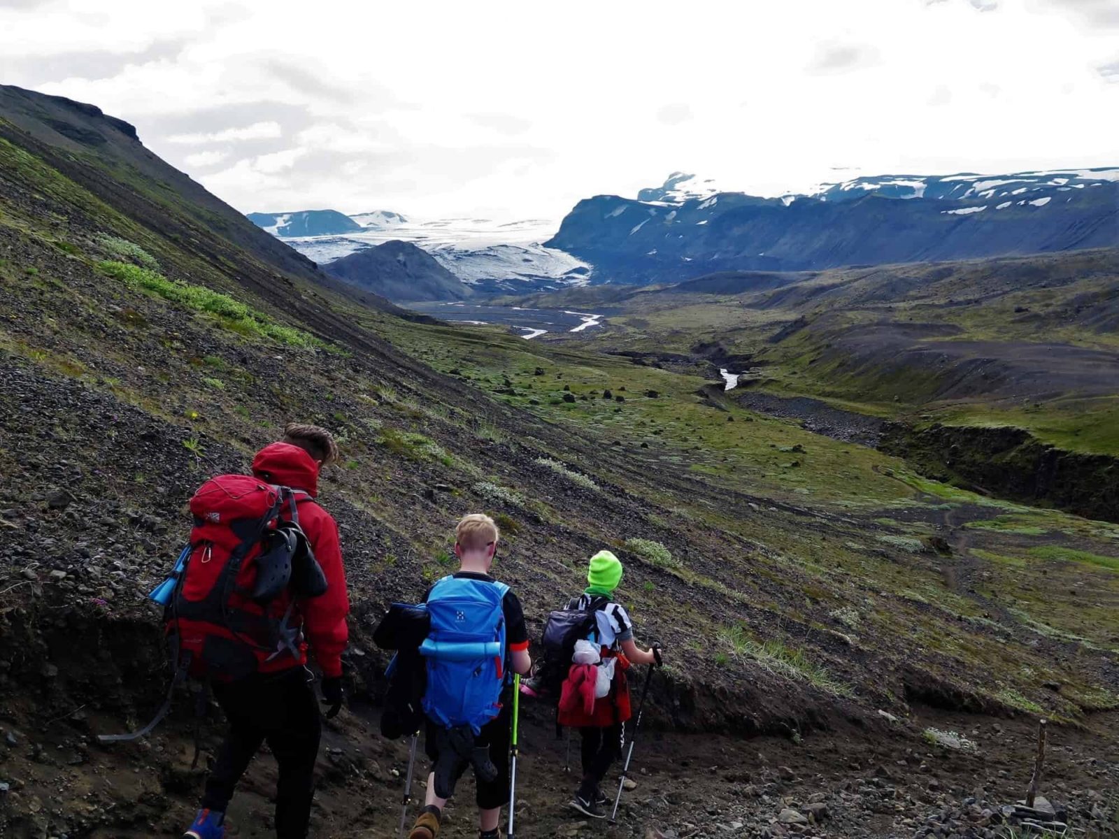
There is no wonder that the hiking trail between Landmannalaugar and Þórsmörk is the most popular one in the Wapp since it is one of the most popular hiking trails in Iceland. National Geographic even listed it as one of the most beautiful trails in the world. The trail goes through incredibly colourful rhyolite mountains, black obsidian lava, wheezing hot springs, lakes clear as a mirror, black sandy desert and ends in a lush forested area. The most common starting point is Landmannalaugar and the distance from Reykjavik is 180 km, but keep in mind that it is in the highlands so the road can be impassable during the winter and until late June or early July. The season for this hike is therefore July, August and even September.
2. Fimmvörðuháls Trail
The route from Skógar, between Eyjafjallajökull and Mýrdalsjökull, along Fimmvörðuháls (Five Cairn Ridge) over to Þórsmörk, is very popular. Its name is derived from five cairns which once stood there, guiding the way in dark weather. Many people walk the route in one day but it is possible to stay in a mountain hut overnight and use two days for the walk. The route´s highest point is around 1100 metres, between the glaciers in Eyjafjöll and Mýrdalur. At this elevation, you can expect all kinds of weather, even winter conditions during the height of summer. Starting point can be either in Þórsmörk or Skógar, the driving distance from Reykjavik is roughly 150 km for either place but it takes considerable less time to drive to Skogar.
3. Reykjavík Walk
This walk is through downtown Reykjavik and along the way some places are highlighted that relate to either love or passion and some other stuff too. So, if you want to know about Love Street, love balls or simply ask yourself if you can love a particular tree, then this is the walk for you.
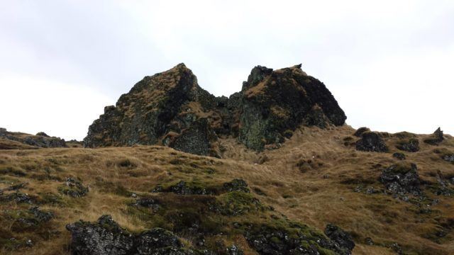
4. Búrfellsgjá Fissure
Mt. Búrfell was formed in a single volcanic eruption just over eight thousand years ago. Fissure (gjá) is really not the correct term for Búrfellsgjá because it is essentially a beautiful and seemingly intact lava channel, just over three kilometres long. The hiking trail is along paths, however the paths are stony in some areas and the slopes of Mt. Búrfell are gravel slopes so trekking poles can be useful. It is located close to Heiðmörk and is only 15-20 min drive from Reykjavik.
5. Fógetastígur Trail in Gálgahraun
Gálgahraun (Gallow´s Lava) is a unique lava field in Álftanes which originates from Mt. Búrfell above Hafnarfjörður. It is a part of a much larger lava flow from about 8000 years ago, known as Búrfellshraun. Gálgahraun gets its name from a few tall, cleft rocks called Gálgaklettar (Gallow´s Rocks) where allegedly criminals were hanged and buried. Old paths lie across the lava, the best known one is called Fógetastígur (Sheriff´s Path) and of course there is Sakamannastígur (Criminals´ Path) as well. Gálgahraun is only 10 min drive from Reykjavík.
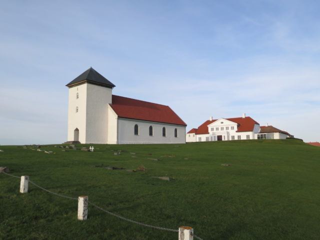
6. Bessastaðanes
This walk is in the neighborhood of the official residence of the President of Iceland. It is a very distinguished locale in Icelandic history and should be regarded accordingly and afforded due respect. Please observe that it is not allowed to approach any other buildings than the church and it is not allowed to walk across the grass fields. The trail goes down to the shore and from there along the coastline by Lambhúsatjörn pond and over to Bessastaðatjörn pond with plenty to see for the young and old. There are bits and pieces from the history of Bessastaðir in the description and most people are fascinated when the bit on the ghost of Bessastaðir is read. The drive to Bessastaðir from Reykjavik is around 20 min.
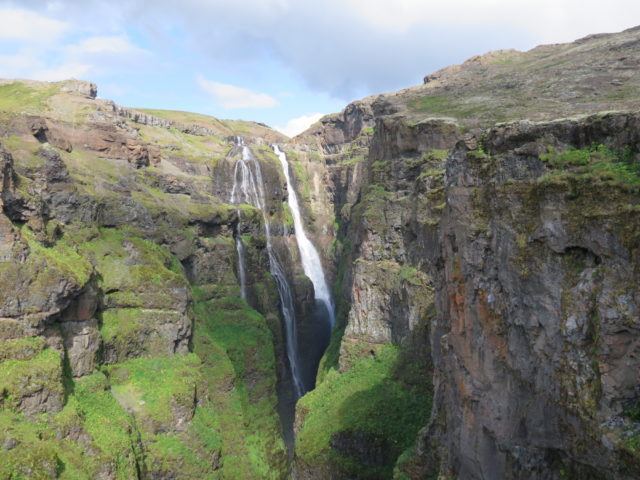
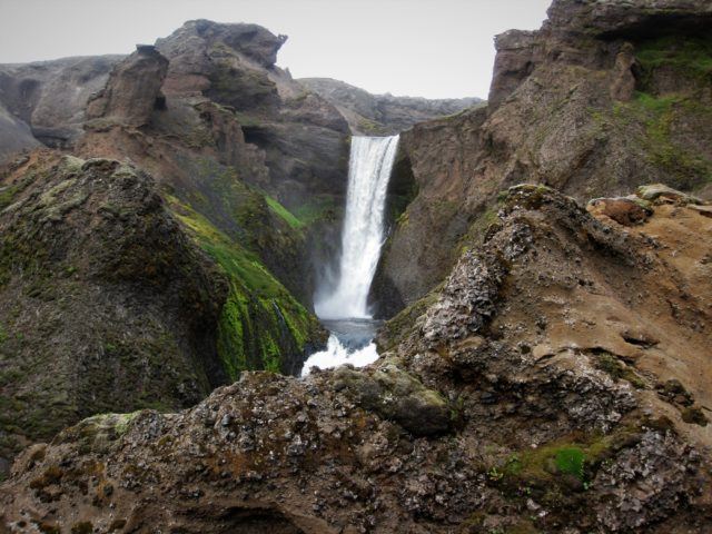
7. Glymur Waterfall
The hiking trail up to Glymur, the highest waterfall in Iceland, leads you through birch shrubbery and alongside gorges and canyons carved out of tuff. The view of the Glymur canyon and the Hvalfjörður fjord is spectacular. It is necessary to cross the river to see the waterfall Glymur because it can only be viewed from the east side of the river. However due to flooding of the river the tree trunk across is only there in the summer months, at other times it is necessary to wade across. The drive from Reykjavik to the starting point of the hike is about 70 km and takes an hour.
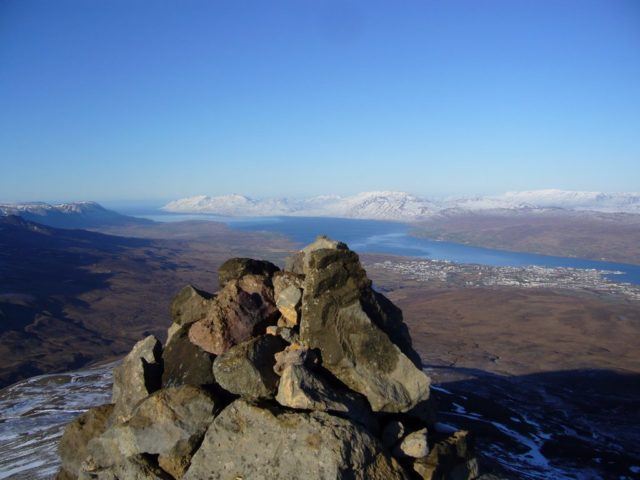
8. Mt. Súlur in Akureyri
Mt. Súlur are the landmark mountain of Akureyri, rising majestically, light in colour, from a broad basalt range. The mountain has two peaks. Syðri-Súla (South-Súla) is the higher one, 1213 m, but to the north Ytri-Súla (Outer-Súla) reaches to almost 1200 m height. East of the mountain is Glerárdalur valley, opening to Eyjafjörður at Akureyri. Hiking Súlur is very popular, the mountain is accessible to most people in reasonable shape. The path is marked and clear, a little steep towards the top, but no rock-climbing necessary. From Ytri-Súla there is spectacular view of Eyjafjörður, Glerárdalur and east towards Vaðlaheiði and further. Akureyri is situated 400 km from Reykjavík and the path to Mt. Súlur is only a 10 min drive from Akureyri.
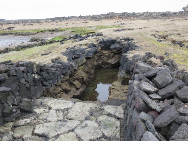
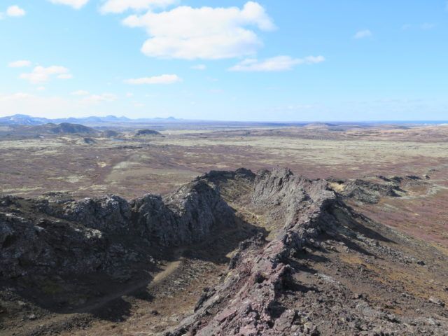
9. The Lava Circle in Reykjanes Geopark
This trail is in Reykjanes UNESCO Global Geopark in the south-westernmost part of Iceland, where the Mid-Atlantic Ridge rises from the sea and signs of volcanic activity are all around. It commences at a car park at Reykjanes lighthouse, follows the fault on the boundaries of the Eurasian and North-American tectonic plates, to the lighthouse in Skemmur, across Mt. Skálafell and to the infamous Gunnuhver (Gunna´s Geyser) before heading back to the Reykjanes lighthouse. It is a 45 min drive from Reykjavik.
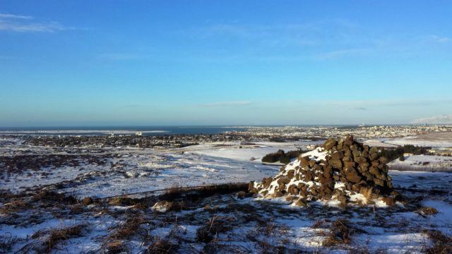
10. Vífilsstaðavatn Lake and the Cairn Gunnhildur
Vífilsstaðavatn is a beautiful natural lake with diverse flora and birdlife. In the spring and early summer the birdlife is abundant and in the autumn you can see the trout (Salmo trutta) flare its gills where it spawns at the source of the stream Vífilsstaðalækur.The trail is usually passable all year around except when there has been a lot of snowfall which can create thick patches of ice and hard frozen snow that can be obstacles on the way up to the Gunnhildur cairn. The trail circles the lake and then leads you up to the cairn Gunnhildur. On the itinerary of this route is the history of Vífilsstaðir and of tuberculosis in Iceland. It is situated on the outskirts of Reykjavik and only 10 min drive.
[amazon_link asins=’1852848057,1631218131,1465440933,1566955343,149758356X,B003RQHGP6,1786574713,1743214758,9935936910,B006QF3TW4′ template=’ProductCarousel’ store=’stuckinicelan-20′ marketplace=’US’ link_id=’a11357ac-f8d2-11e8-9bc2-d544a9c151e9′]