Free and exclusive discount codes for hundreds of tours and & travel services in Iceland
Subscribe to instantly receive discount codes for tours, car rental, camper van rental, and outdoor clothing rental. Thank you! ❤️ Jon Heidar, Editor of Stuck in Iceland Travel Magazine14 years ago I hiked the Fimmvörðuháls, or Five Cairns, hiking train. It was a disaster since the weather was atrocious. I wrote about that trip and entitled the article, ‘Hiking in Iceland when the weather is s***‘. But now I have just completed hiking and I am tempted to entitle this article: Hiking in Iceland when the weather is dreamy and the view is so amazing I thought I was high even if I only had Snickers and Powerade.
Hiking Fimmvörðuháls with the birthday girl
I took my daughter with me this time, she would turn 19 the day after we finished the tour so we came prepared with a small bottle of Moët & Chandon champagne. We would open on the following night. Nothing but the best for my mountain queen!
One of Iceland’s major hiking trails
The Fimmvörðuháls hiking trail is one of Iceland’s classic routes. Other ‘classic’ hiking trails include Laugavegur hiking trail and the Kjalvegur trail. I have gone on all of them and I can’t choose my favorite. The weather and the company is always a deciding factor though so on that measure I would say that my recent trip hiking Fimmvörðuháls is my favorite hiking trip of all times.
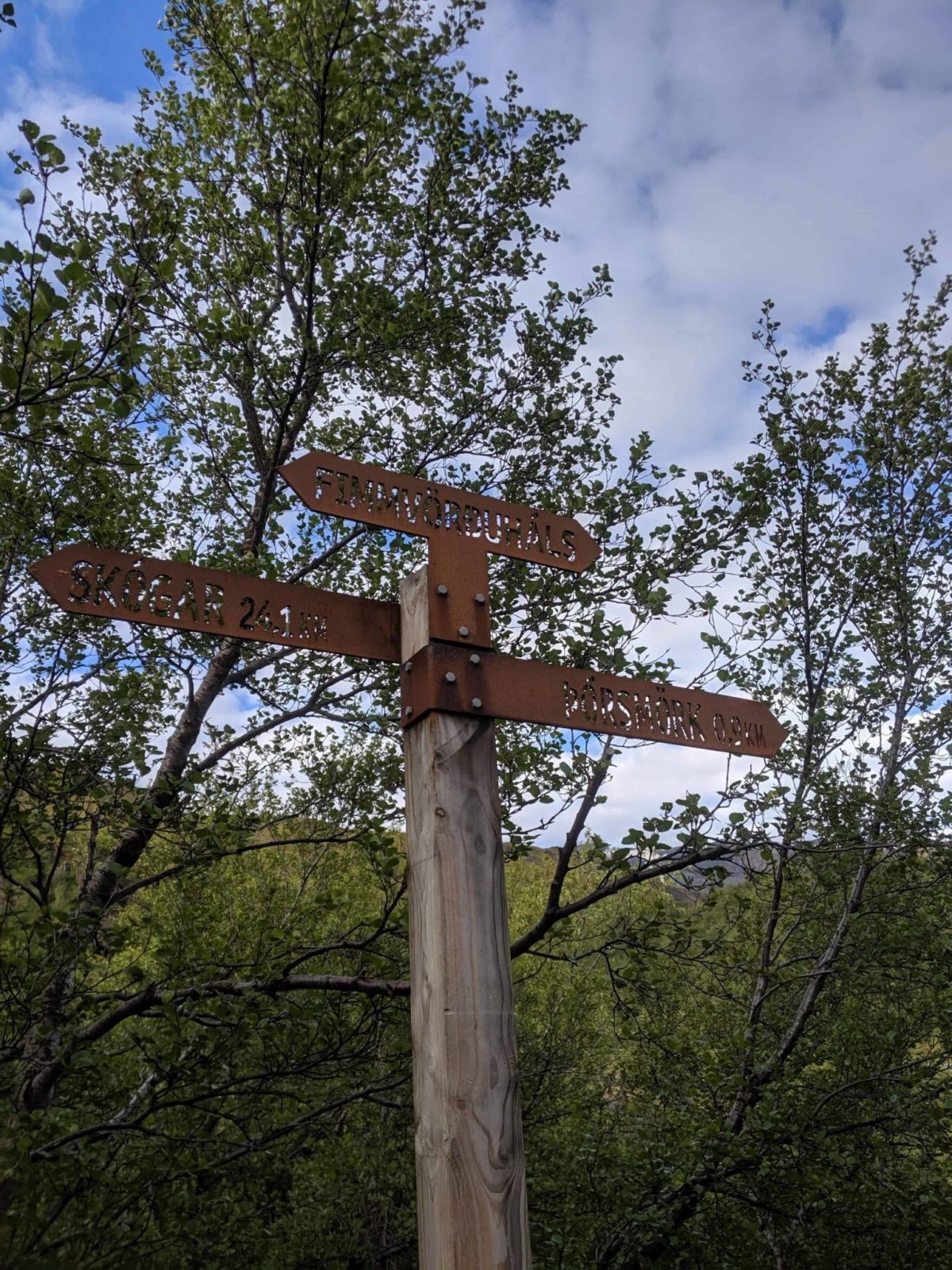
You can sleep when you get to Þórsmörk
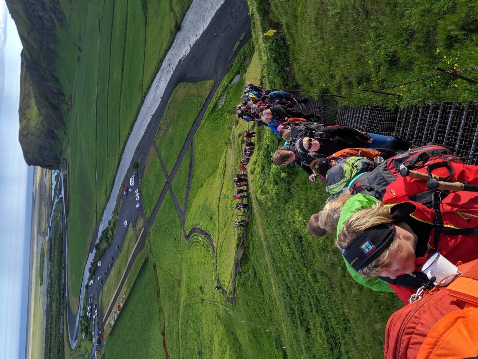
Just like 14 years ago, we joined the Icelandic travel club Útivist for their annual solstice night hike across Fimmvörðuháls. The journey starts at Skógar. That place is famous for its beautiful and impressive Skógafoss waterfall. We started out around eight on Friday evening and in total the 26.5KM (16 miles) hike to Þórsmörk took us ten and a half hours. In total just over a hundred people joined the hiking trip. Most of the Icelandic. They were all great company but to be honest the main thing for me was to spend time with my daughter. She was a champ the whole time and left me behind in the dust.
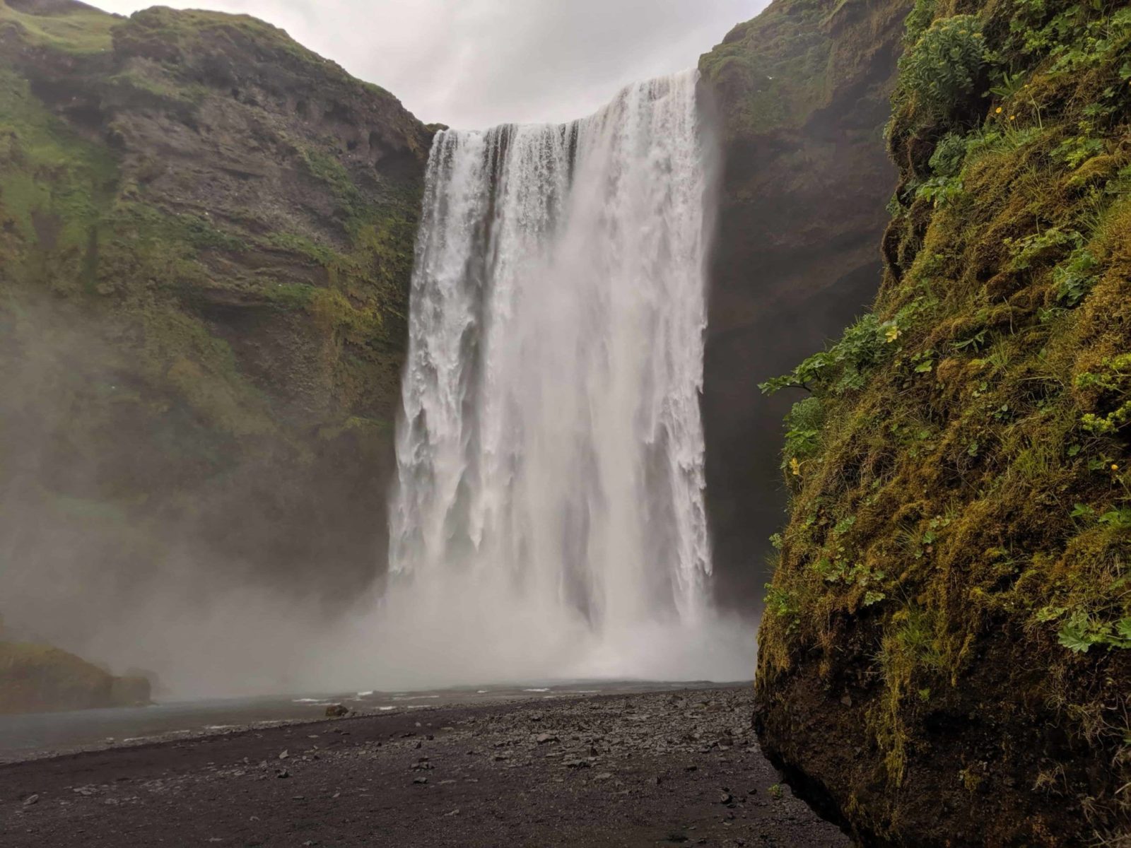
The beautiful Skógar trail is the start of hiking Fimmvörðuháls
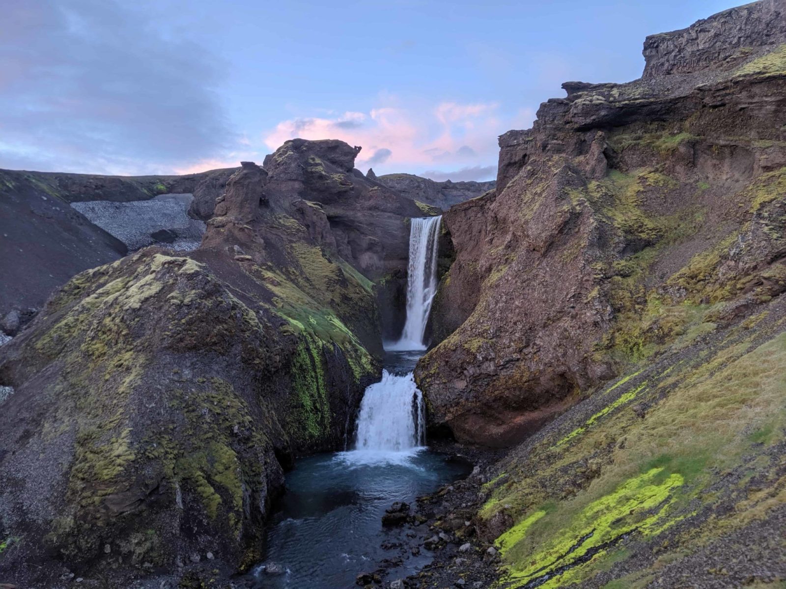
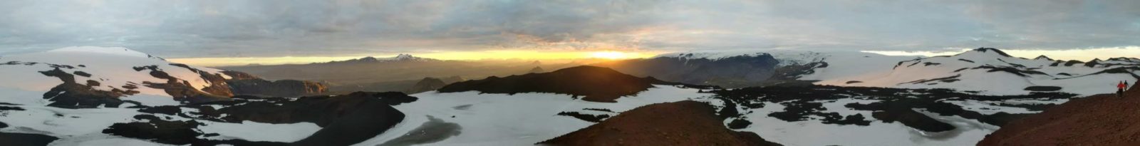
Anyway, we started out at Skógar and right from the start the weather was incredible. Clear sky and the assortment of the dozens of waterfalls in the Skógá river made the first part of the hike just incredible. The canyon of Skógá river is really impressive and I would recommend that if you stop by Skógar, you take the time to hike the trail right next to Skógá river. It is easy to find, just go up the stairs next to the waterfall and you are on your way You don’t have to go the whole distance but according to my Garmin GPS watch you can hike up to 6 – 7 kilometers up the hiking trail there and see so many beautiful waterfalls along the way.
The art show in the middle of nowhere
At the river crossing at Skógá, we stopped and there, trucks waited for us with a warm cup of lamb soup and one guy even had a small art exhibition in a trailer. It was pretty cool. The lamb soup was excellent, for me it was a taste of nostalgia since we hardly ever have it for dinner. That needs to change!
More outdoors gourmet stuff on the Fimmvörðuháls hiking trail
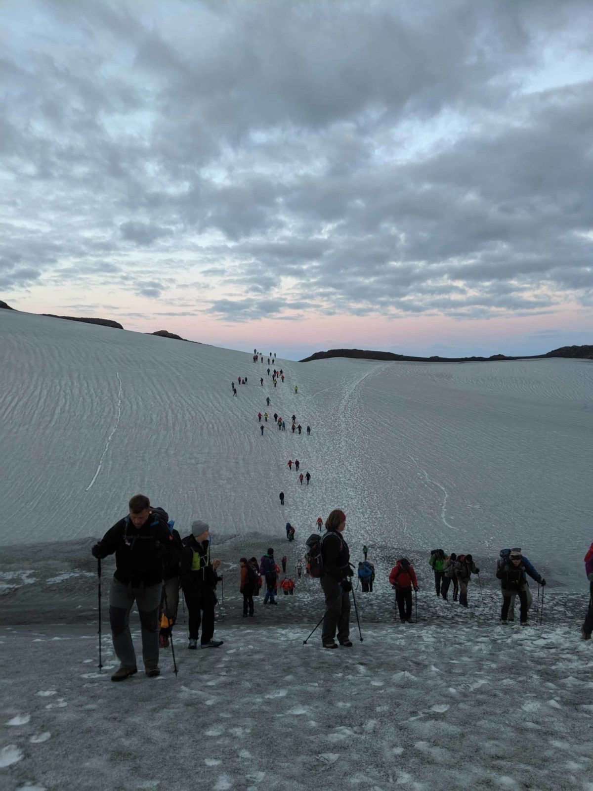
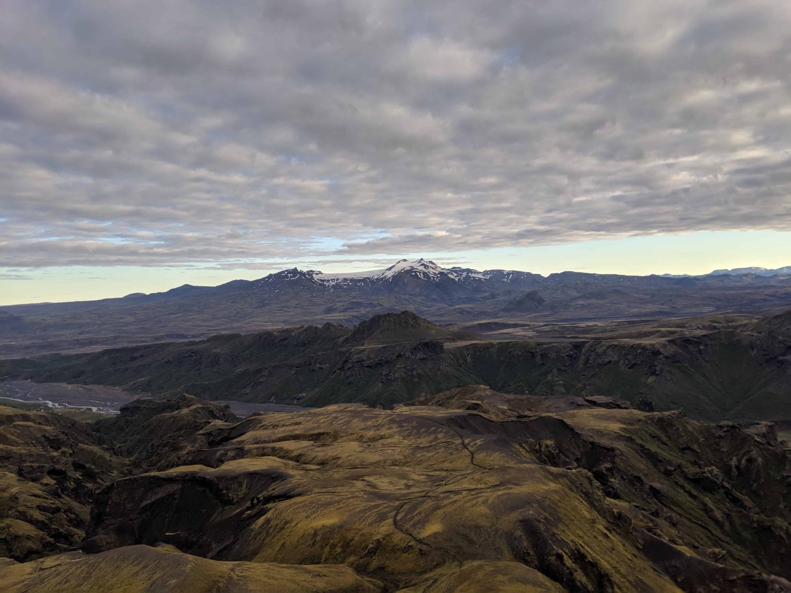
The next stop was the Baldvinsskáli hut, approximately four kilometers away. The nice folks of Útivist fed us more, this time we had a gourmet snack of flatbread with butter and smoked lamb. Hot cocoa was also served. What a treat. After Baldvinsskáli the trail leads you on to the Fimmvörðuháls itself. This part of the trail is mostly covered in snow and it takes you right between two massive glaciers who both have huge volcanoes beneath them. Eyjafjallajökull which erupted in 2010 and Katla which lies under Mýrdalsjökull and is, according to geologists cocked and locked for an eruption.
Walking next to the new lava
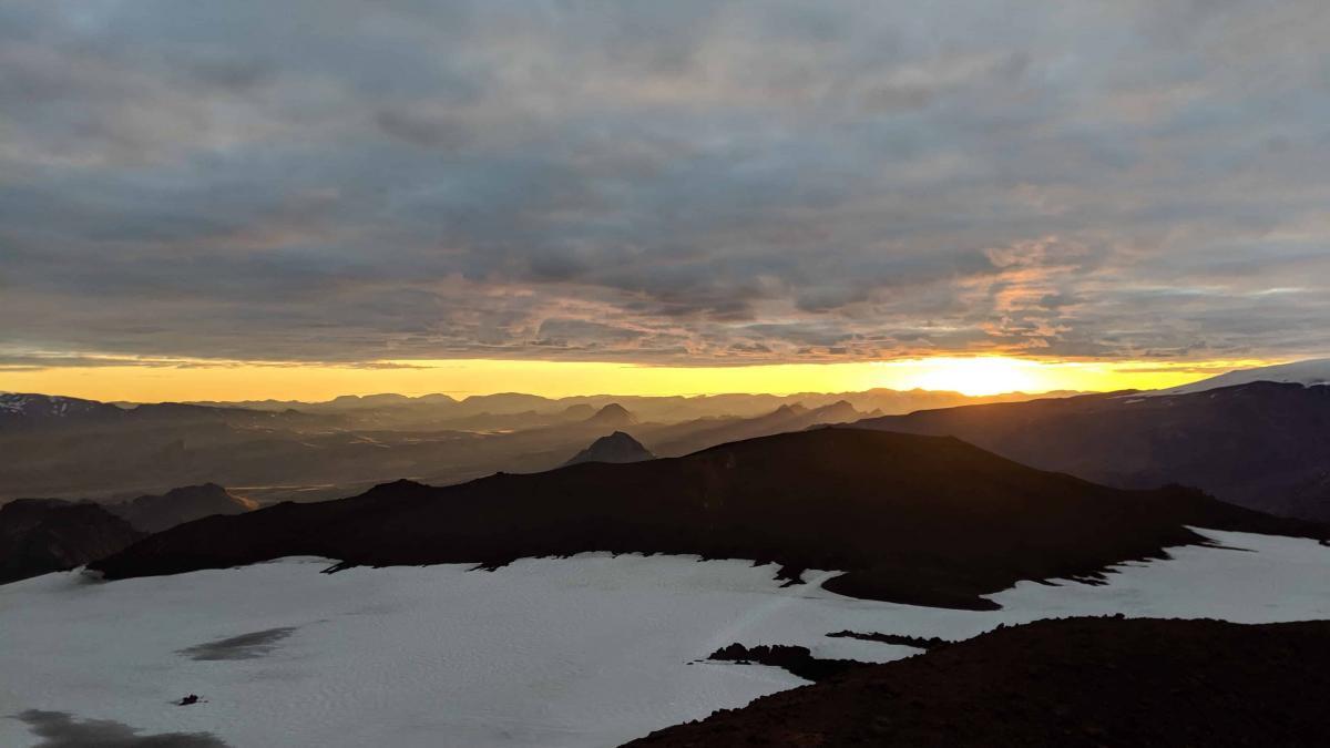
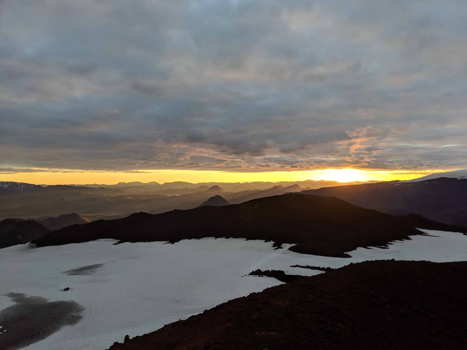
A really cool part of the trail is when you get to the new hills of Magni and Móði. These were formed in the now largely forgotten small eruption which preceded the Eyjafjallajökull eruption in 2010. You walk past the new lava and walk in wet sandy pumice. At this point, the sun rose and the top of Eyjafjallajökull and the snowy ground there was illuminated by the golden sun. A moment of spectacular serenity and beauty.
Meeting the sons of Thor
Our next stop was at the top of Magni. Like its brother Móði, it is named after the sons of the Norse god Thor. The name is apt due to their proximity to Þórsmörk which literally means the ‘Forest of Thor’ At the top, the view was just spectacular. I am not very good with words but I have a feeling that many experienced wordsmiths would be challenged to bring the sunlit scenery to life with words. Photos will also not do the view or the moment justice.
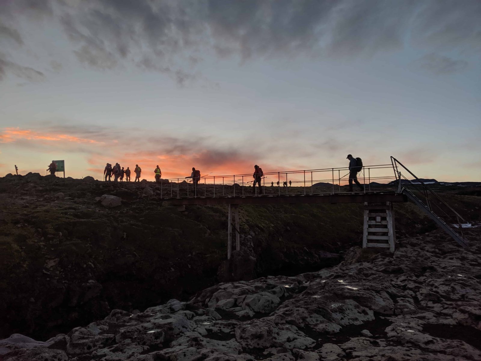
After that, we headed to the only way down to Þórsmörk, our eventual destination.
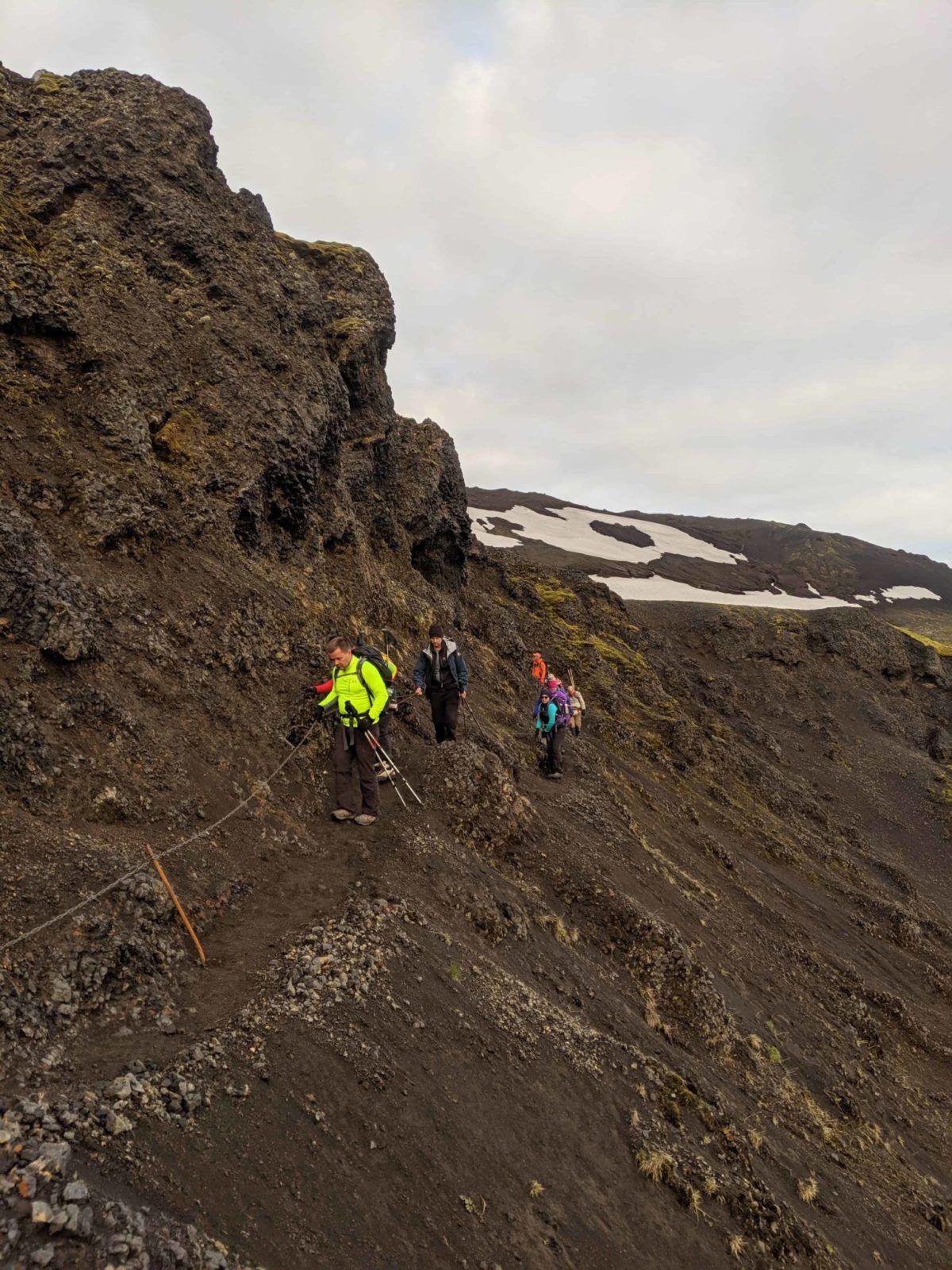
Crossing Hell’s Ridge
This is Heljarkambur which might translate to Hell’s Ridge. This would be scary but since a solid steel chain helps you to navigate the narrow path on the ridge, this is no big deal. Without the chain, there is no way in hell I would try to cross!
Don’t go it alone
And this is an important reason why you should not be hiking Fimmvörðuháls without an experienced guide. There is just one way down to Þórsmörk. All around there is just a sheer drop, perhaps 100 meters or more straight down. So imagine being there in the fog and trying to find your way alone! In any case, this area is infamous for fast changing and horrendous weather. So never, ever attempt to hike this trail without an experienced guide.
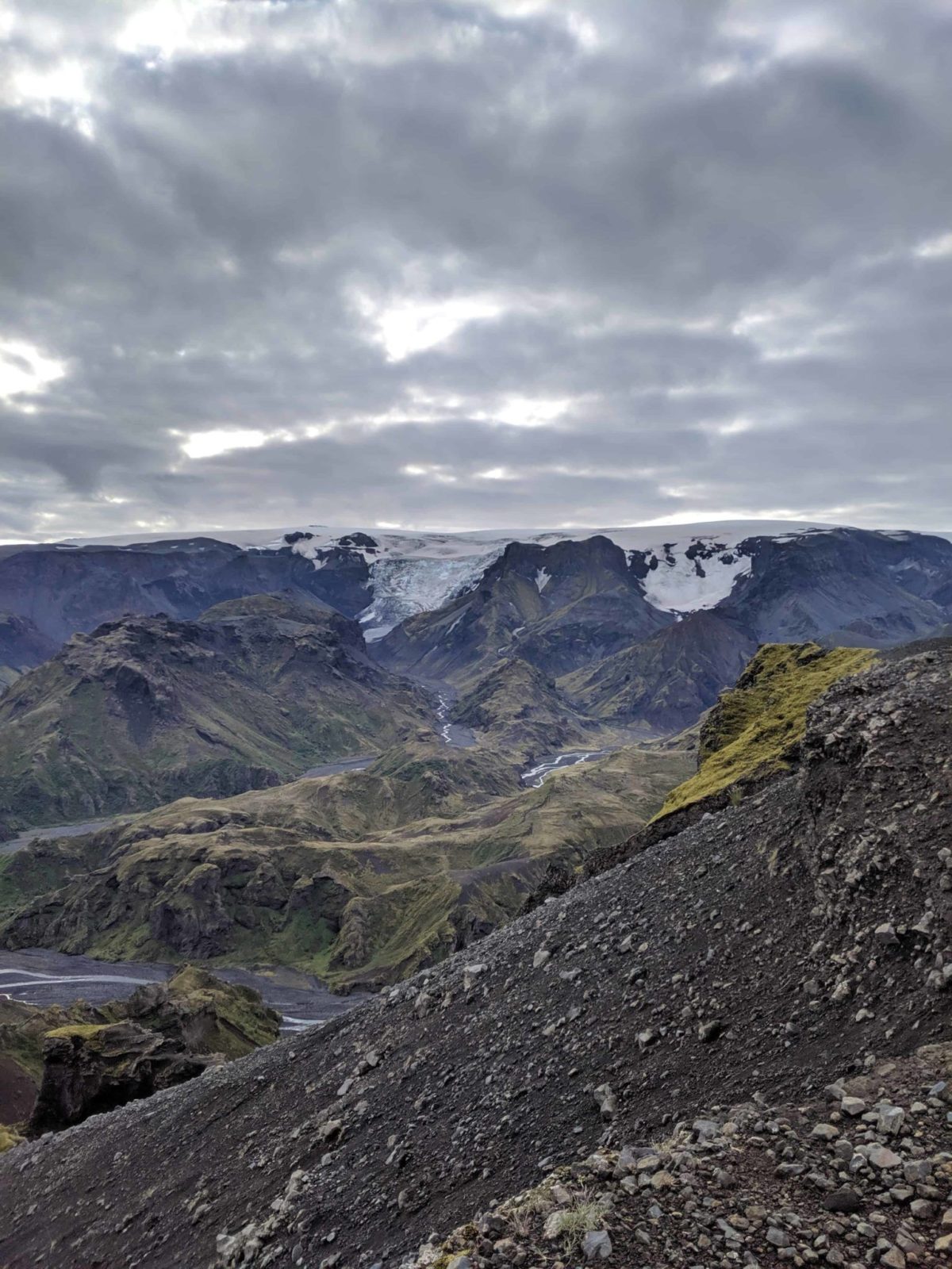
The glacier wakes everybody up
We stopped there and to our right-hand side, we had Mýrdalsjökull glacier. All of a sudden there was a thunderous crack from the glacier, a large ice sheeting had collapsed from the glacier’s icy wall. The noise was enough to cause quite a stir. It was eerie to look at the steely glacial wall after this noise. You know there are great forces at work within but you don’t notice them before they manifest themselves suddenly with great effect.
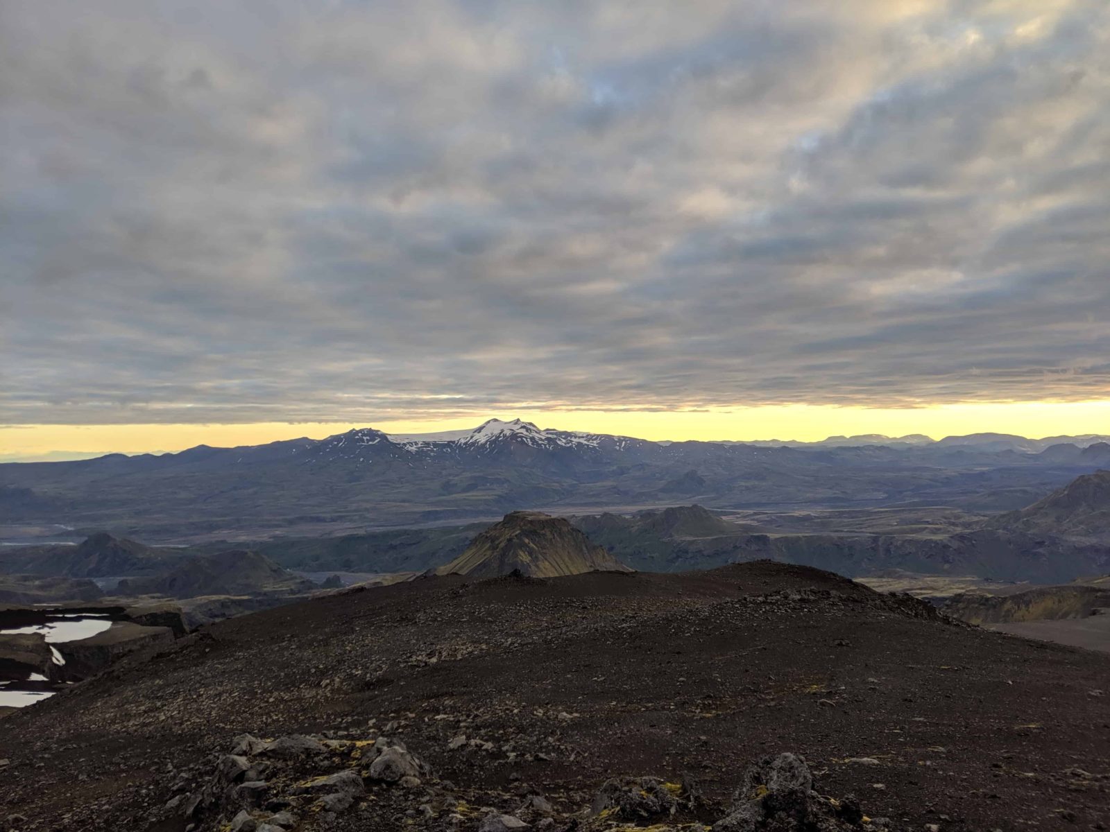
The view was out of this world on the Fimmvörðuháls hiking trip
The view was, again the main star of the show. Below you, you could see the Þórsmörk area and in the distance, steam was rising from the geothermal area around distant Hrafntinnusker. This is one of the stops on the Laugavegur hiking trail. Útigönguhöfði hill was also impressive.
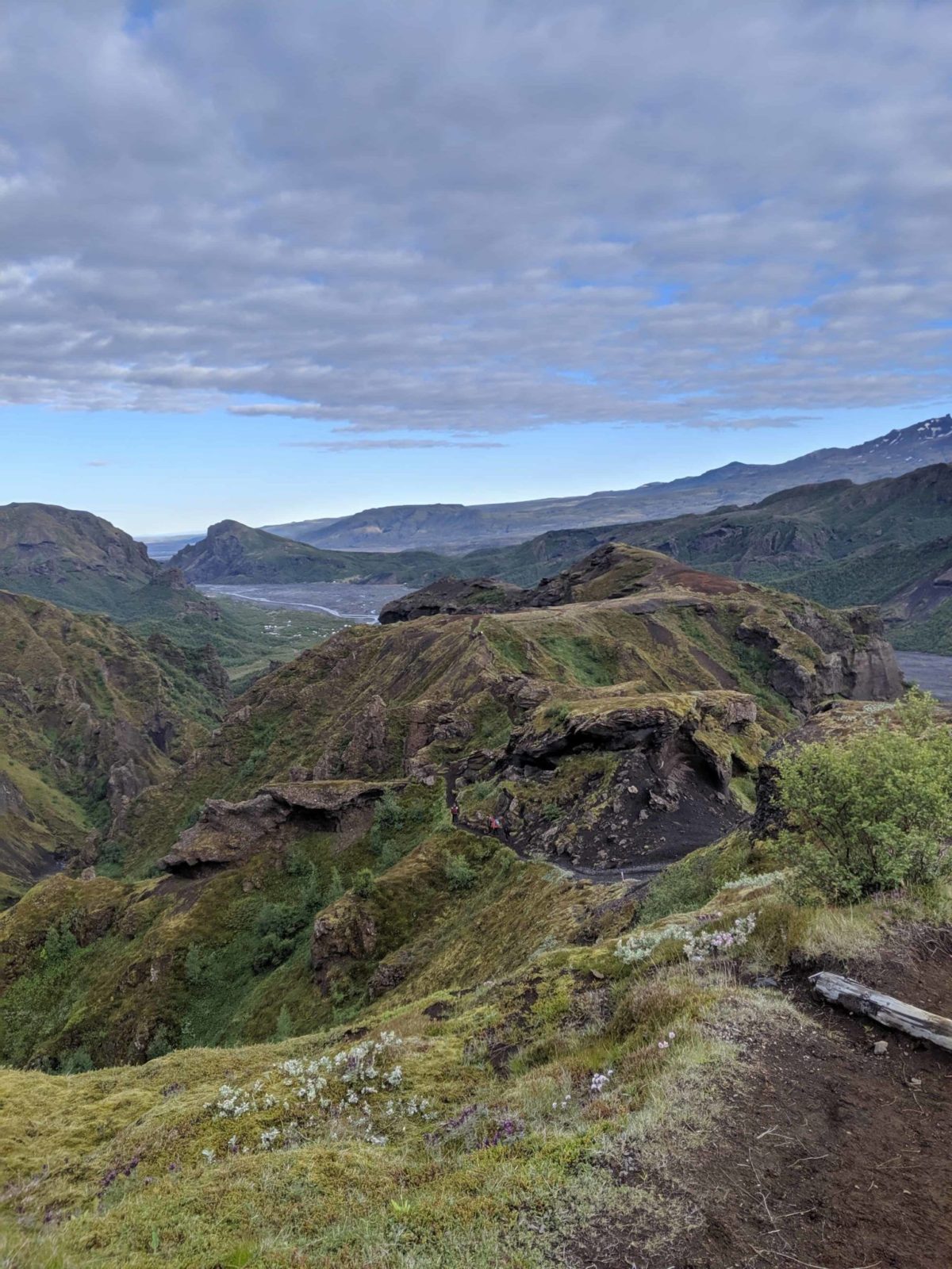
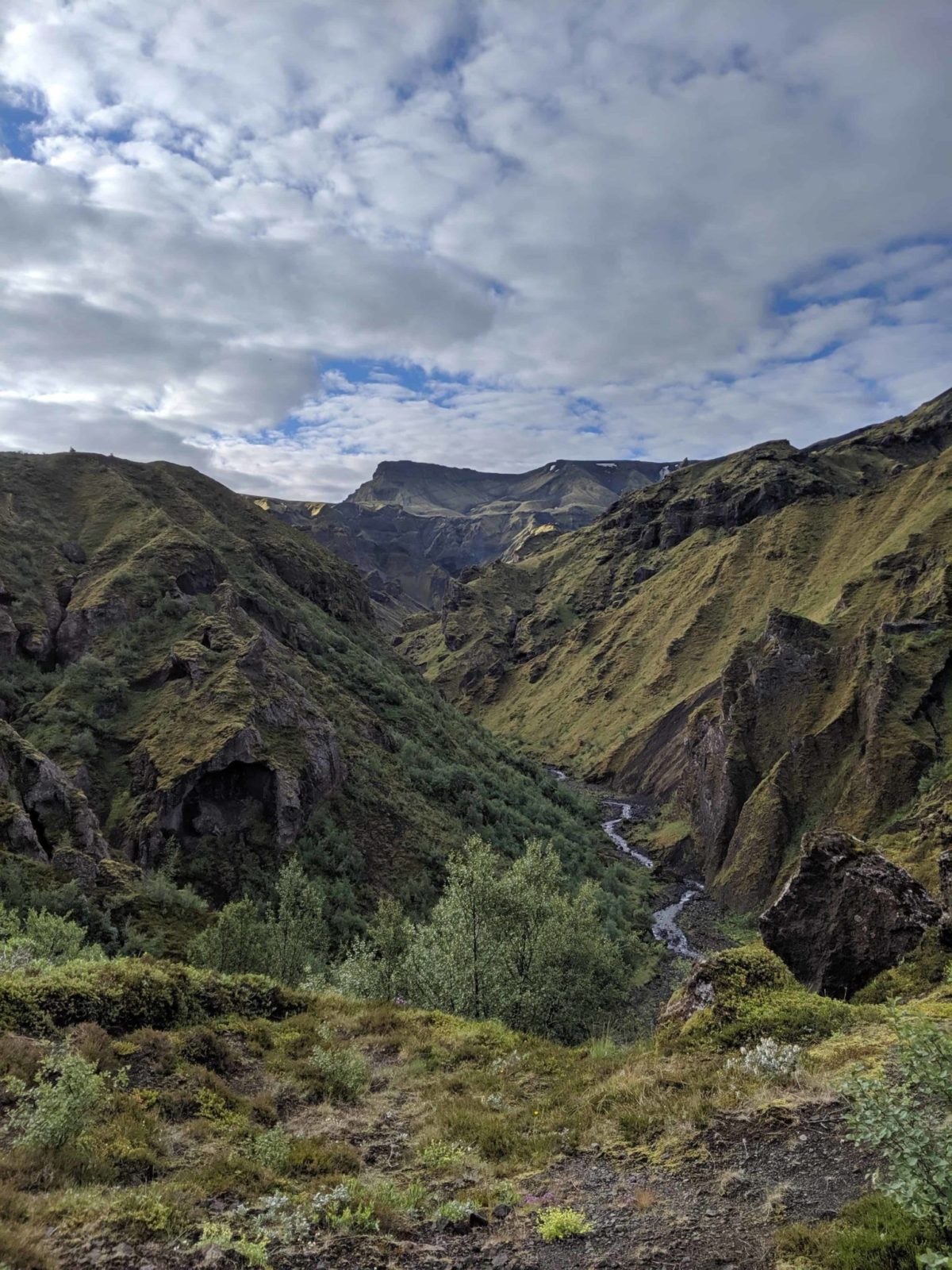
Getting down to Þórsmörk
After Heljarkambur the path to Þórsmörk lies across Morinsheiði. Literally, this means the heath of red rust sheep! This is a pretty cool place, it is a flat piece of land which looks like a bulldozer went over it and flattened it. The culprit would be a glacier sometime way back in time. After a little walk, we reached Kattarhryggir or cat’s ridges. As the name suggests these are really narrow ridges with a sheer drop on either side. I was able to navigate this well in spite of my vertigo, at one point there is a rope to help you along.
Cod liver oil and Jagermeister are great to finish hiking Fimmvörðuháls. Skál!
From the cat’s ridges, it is down Strákagil or boy’s gully. This is one of the most beautiful places I have ever been to. Period. Around 7.30 in the morning we came to the end of the hike, nice ladies waited after us with shots of cod liver oil or ‘Lýsi’ and Jagermeister. I had both for good measure. Then it was time to take our exhausted selves to the hut where we crashed our sweaty selves into bed. After 10,5 hours and over 26 of hiking, we deserved the rest.